Drone Imaging Services
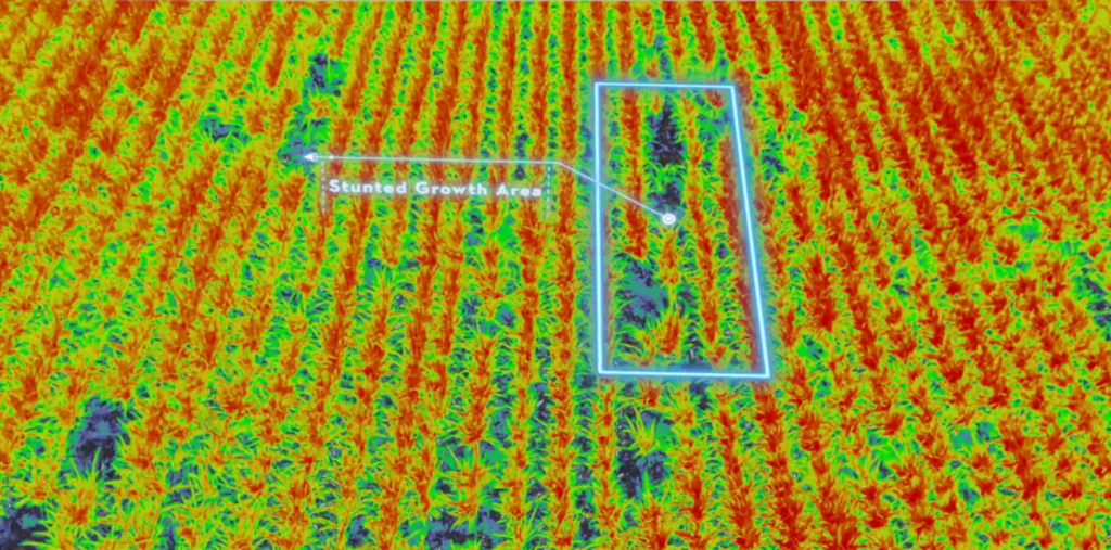
Our advanced aerial imaging technology provides detailed, high-resolution maps and data analysis, allowing you to monitor crop health, assess field conditions, and make timely in-season decisions. With multispectral imaging, we deliver insights that help you optimize irrigation, identify pest issues, and enhance overall farm management.
Why Choose Drone Over Satellite Imagery?
While we could list numerous reasons for our superior imaging resolution, a visual speaks volumes. In comparison, satellite imaging typically has a Ground Sample Distance (GSD) of about 3 meters (118 inches) per pixel. In contrast, our advanced imaging technology delivers an average GSD of just 7 inches, regardless of cloud cover—nearly 20 times clearer. For specialized surveys, such as stand or tassel counts, we achieve an impressive GSD of 0.10 inches per pixel, allowing you to almost identify individual weeds!
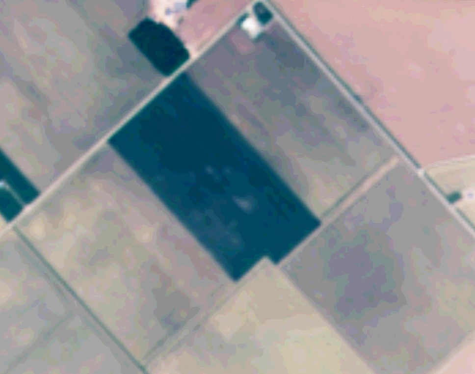
A standard satellite image. GSD of about 3 meters/pixel (118 inches/pixel). Good atmospheric conditions are a must, even for multi-spectral imaging.
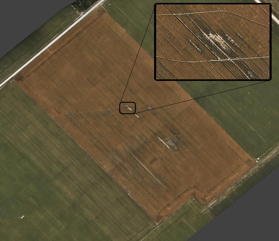
The same field flown by our imaging crew. It has a GSD of 0.178 meters/pixel (7 Inches/pixel). NOTE: This was flown almost 2 weeks later then the comparison satellite image. This is due to the cloud cover that prohibited good satellite imagery.
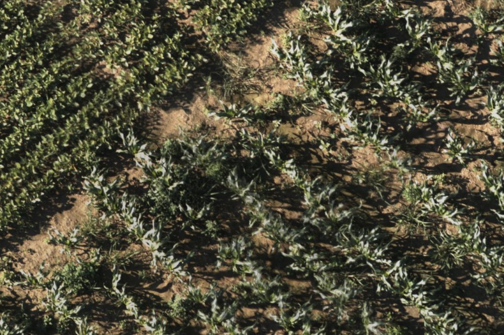
This is a sample of a specialty flight at a 50 feet altitude over sweet corn. A GSD of 0.0025 meters/pixel (0.1 inches/pixel). Literally over 1,000 times clearer then a satelite.
Our Service, Your Data
Unlike other service providers that offer “free” imaging, we prioritize your privacy and security by not harvesting or selling your data. Our commitment is to serve you, not to generate statistics. Your data is securely stored on our multiple redundancy servers, rather than in the cloud, ensuring its protection for years to come. You will retain access to your data long-term. Remember, when a service is free, the user often becomes the product.
Advanced Imaging Drones
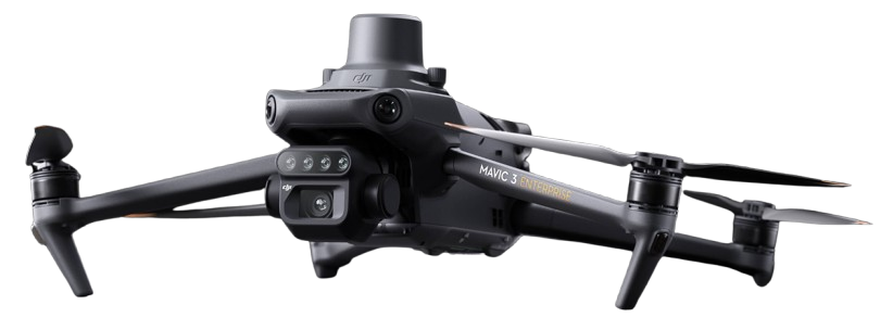
Utilizing the latest technology to capture high-resolution aerial imagery, enabling precise analysis for various agricultural applications. With exceptional versatility and reliability, our fleet is designed to perform detailed surveys, monitor crop health, and provide valuable insights, all while ensuring minimal disruption to your operations. Operating in RTK navigation precision, survey grade imaging is our standard.
Multispectral + RGB imaging system
We utilize research grade multi-spectral sensors that are radiometrically calibrated every flight. This ensures that you get the same data, no matter if it’s overcast or sunny. Five dedicated imagers capture key vegetation wavelengths (Blue, Green, Red, Red Edge and Near-Infrared) as well as a dedicated 20MP RGB Colour imager.
Actionable Data When You Need It
Our advanced processing computers accompany our pilots on-site, enabling us to compile data from a 100-acre flight in just 10 minutes, delivering actionable insights immediately. You’ll receive processed images on a USB drive right in the field, ready for import into your preferred farm management software, or we can provide them directly to your crop advisor. Alternatively, we can create zonation maps in seconds, which you can utilise directly into your shapefile (or .KML, GeoJSON) capable display.
Get In Touch
Have a question? Ready to schedule a demo?
We’re here to help! Reach out to us today.
