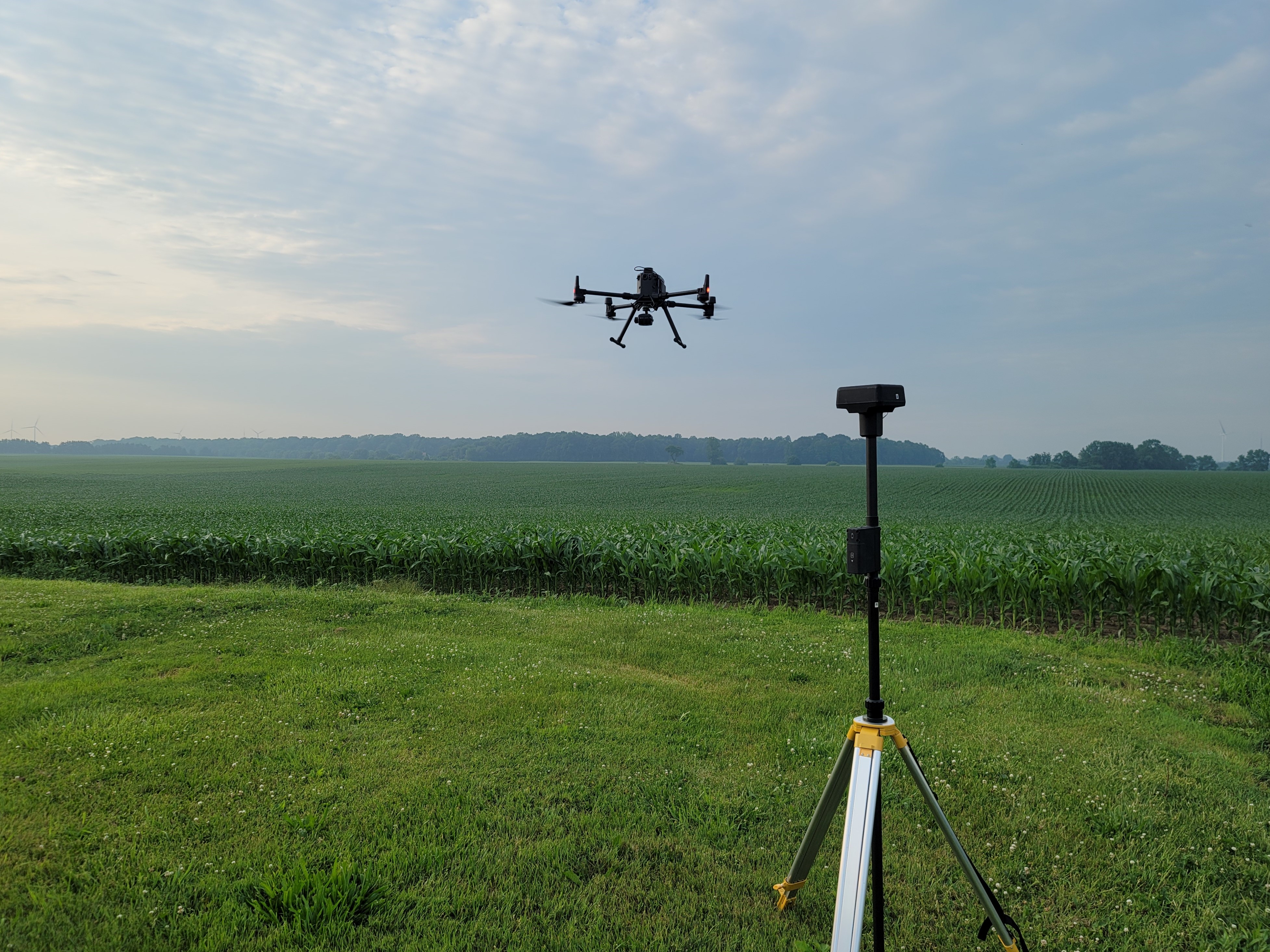
The DJI Matrice 300 RTK is built for inspections. We utilise the incredible accuracy, power, and safety as our main imaging platform. Operating in RTK navigation precision, survey grade imaging is our standard. Capturing data at over 30 MPH, with flight times over 45 minutes per battery, and fast battery hot-swapping means results in serious coverage. The aircraft has many redundancies, as well as ADS-B receiver, which means we can see other equipped aircraft with radar-like situational awareness. Onboard 360° obstacle sensing further enhances safety.
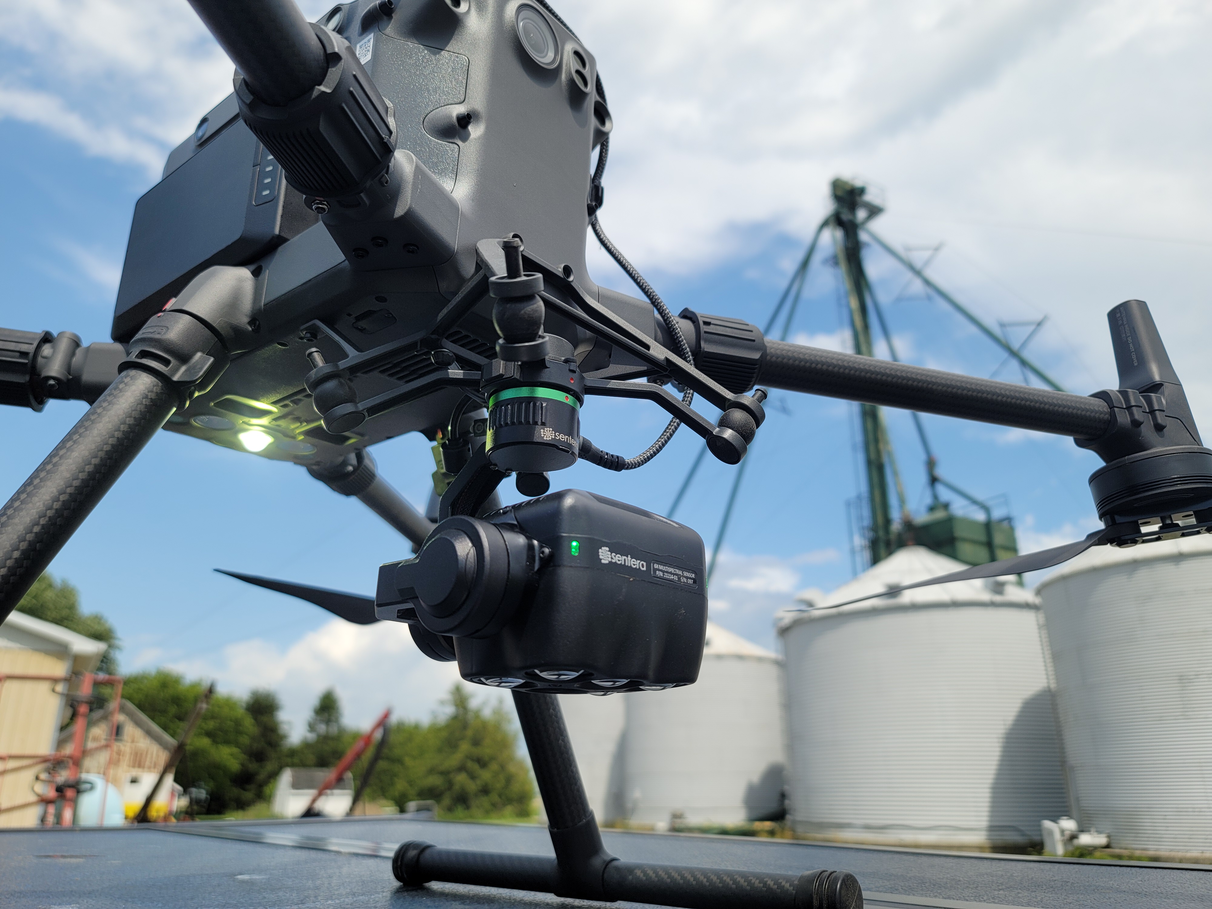
We utilize research grade multi-spectral sensors that are radiometrically calibrated every flight. This ensures that you get the same data, no matter if it’s overcast or sunny. Five dedicated imagers capture key vegetation wavelengths (Blue, Green, Red, Red Edge and Near-Infrared) as well as a dedicated 20MP RGB Colour imager. The Senetra 6x is capable of flying at incredibly high speeds, 5-10x faster then most of the competition. This allows us to fly a 100 acre field with a ground resolution of 0.8 INCHES/Pixel in less then 14 minutes.
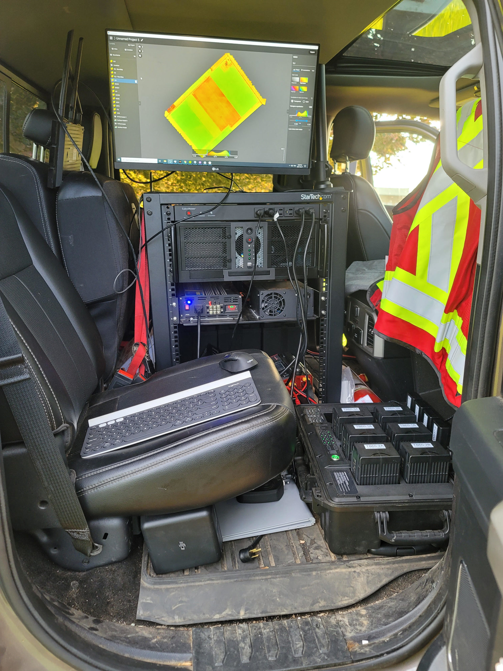
Being where your field is the fundamental part of our services. Our extremely powerful processing computers come on site. Capable of compiling the data of a 100 acre flight in 10 minutes, you get actionable data NOW. We provide you with the processed images, on a USB drive at the field, which you can import into your farm management software of choice, or we can provide to your crop advisor. Alternatively, we can create zonation maps in seconds, which you can utilise directly into your shapefile (or .KML, GeoJSON) capable display. This is of course at your own judgement, we at Drone Spray Canada are not Certified Crop Advisors and do not guarantee results from the data we provide.
OUR Service, YOUR Data
Unlike service providers who may provide “FREE” imaging, we do not harvest or sell YOUR data. Our business is to work for YOU, not to generate statistics. It is kept secure for years on our multiple redundancy secure servers, not the cloud. You will have access to your data for many years. Remember, if you are not paying for a product, you are the product.
Satellites provide NDVI imaging, why use a drone?
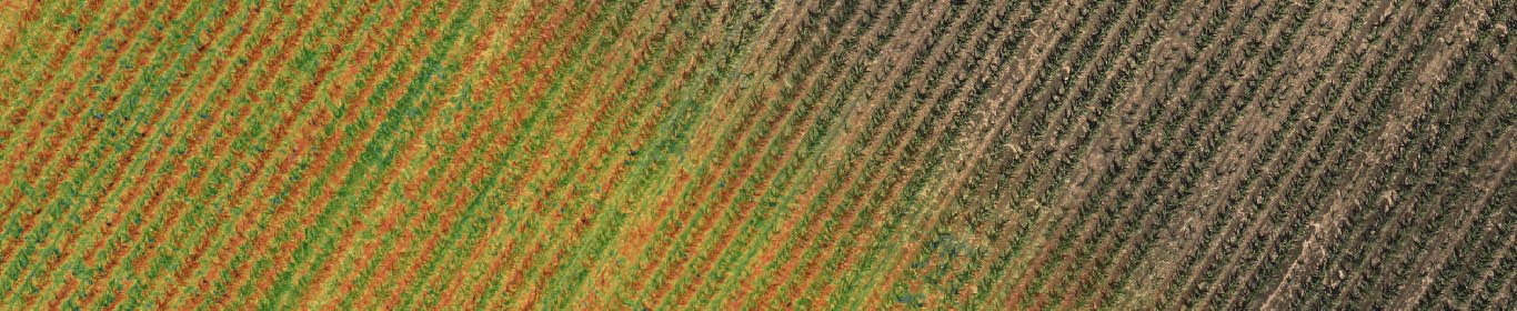
We can write a long list of reasons why we can provide far higher resolution with our imaging technology, but a picture is worth a thousand words. In a brief comparison, nearly all satellite based imaging offers a Ground Sample Distance (GSD) of about 3 meters (118 inches) per pixel. This is for all intents and purposes your resolution. Our rapidly processed imaging provides an average GSD of 7 inches, irrelevant of cloud cover. That’s nearly 20x clearer on our standard service. When surveying specialty areas, such as plots, performing stand counts or tassel counts, we achieve a GSD of 0.10 inches/pixel, you can almost identify the weeds!
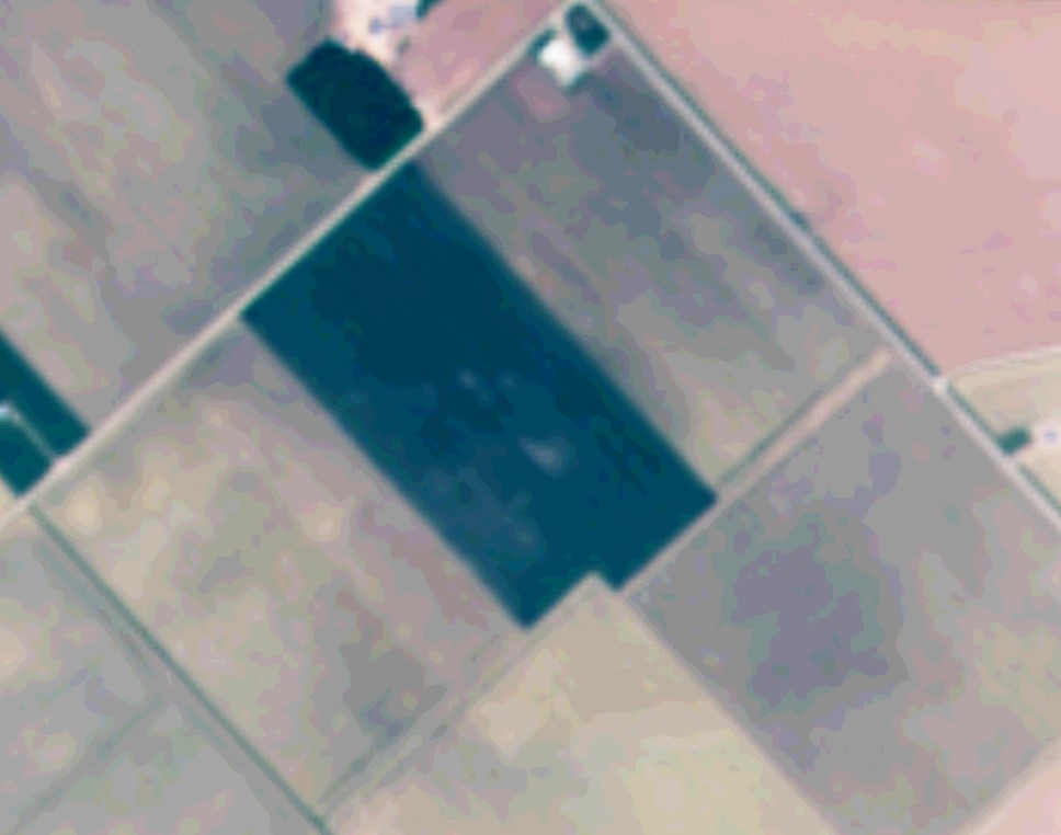
A standard satellite image. GSD of about 3 meters/pixel (118 inches/pixel). Good atmospheric conditions are a must, even for multi-spectral imaging.
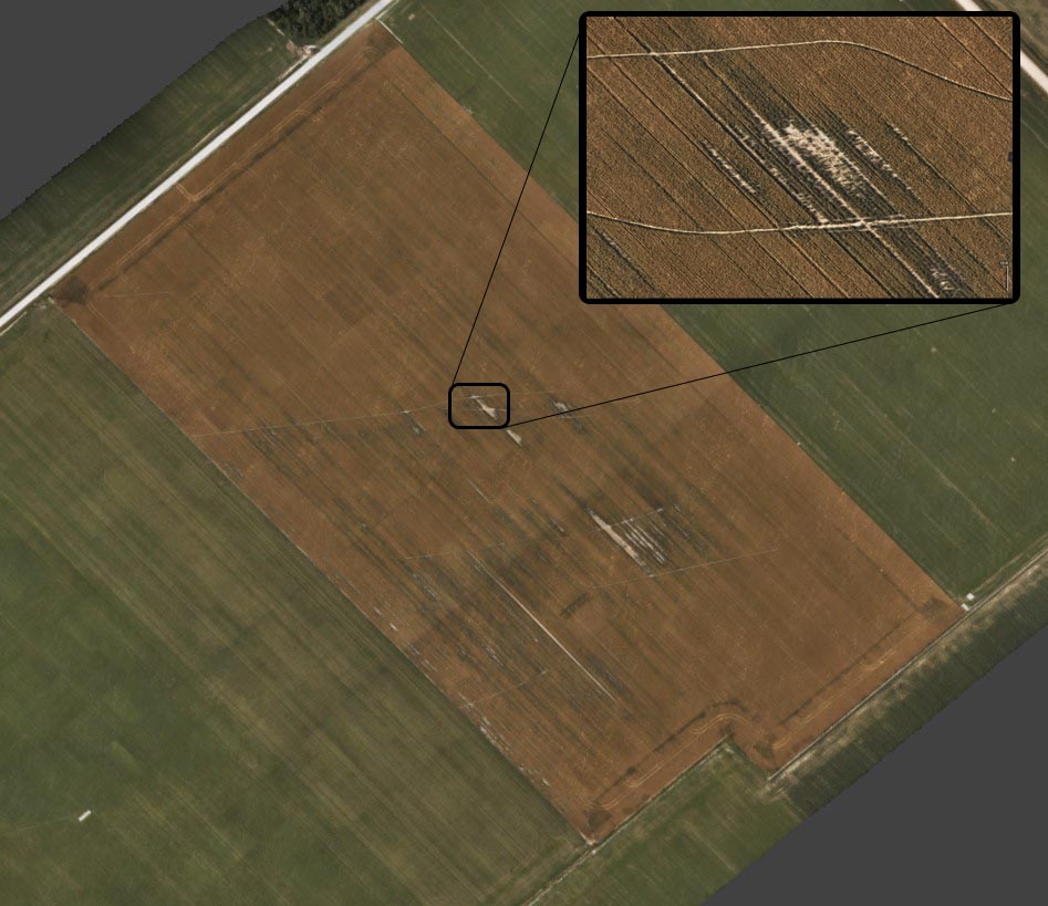
The same field flown by our imaging crew. It has a GSD of 0.178 meters/pixel (7 Inches/pixel). NOTE: This was flown almost 2 weeks later then the comparison satellite image. This is due to the cloud cover that prohibited good satellite imagery. Our sensors are calibrated before AND during the flight to ensure accurate data, sunny, or overcast.
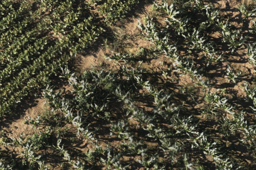
This is a sample of a specialty flight at a 50 feet altitude over sweet corn. A GSD of 0.0025 meters/pixel (0.1 inches/pixel). Literally over 1,000 times clearer then a satelite.